Comprehensive Bathymetric Survey for the Preliminary Study of Jetty Construction in Bojonegara, Banten was undertaken by PT Orecon Sadanus Perkasa in collaboration with Sharpmapping.
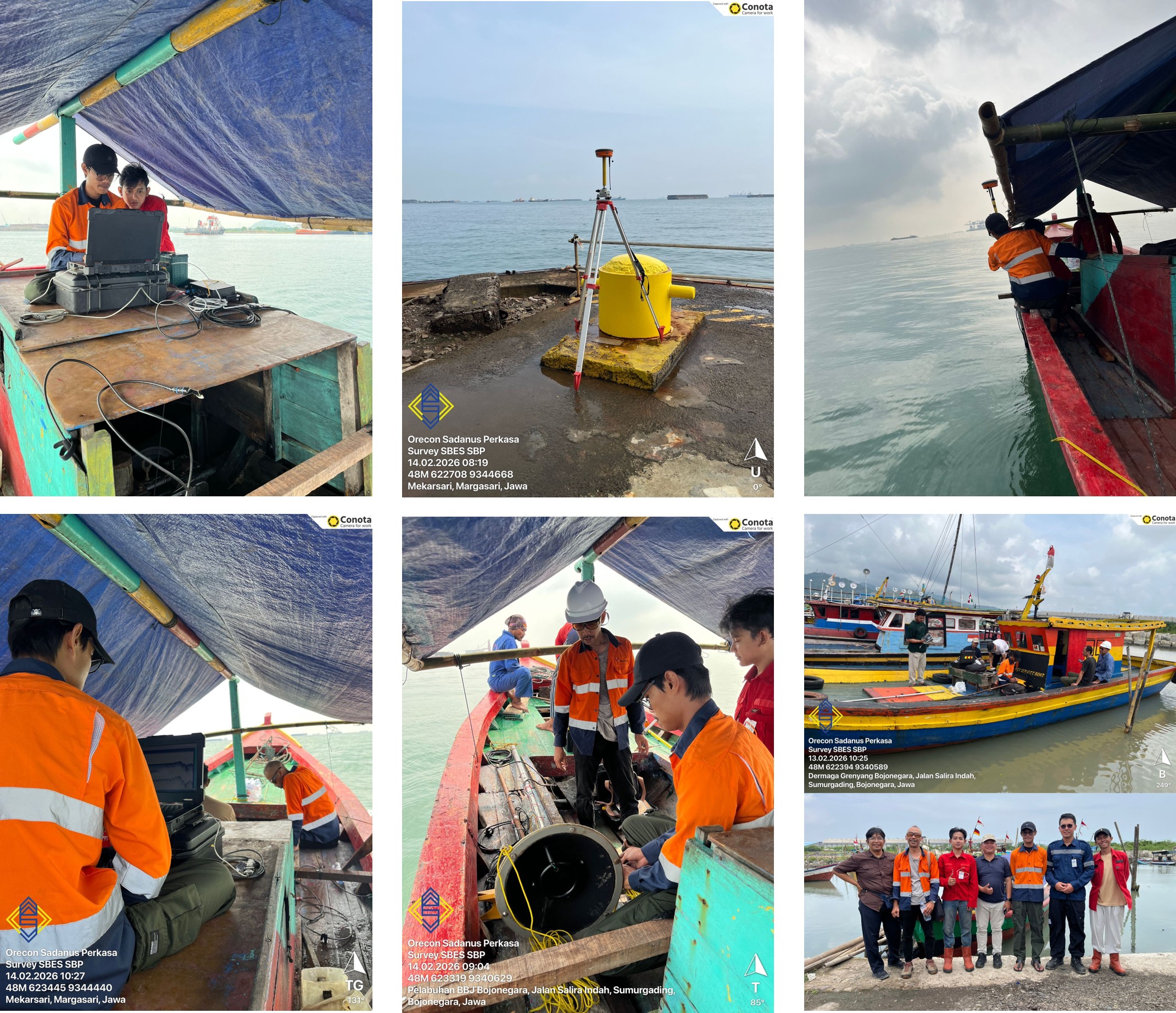
Banten, 2026 — PT Orecon Sadanus Perkasa, through its Engineering Services Division, has conducted a comprehensive bathymetric survey in the coastal area of Bojonegara, Banten as part of the preliminary study prior to the construction of a jetty. The survey was carried out in collaboration with PT Sharpmapping as the appointed survey partner, aiming to provide accurate and reliable technical data to support the planning and construction phases.
The primary objective of this bathymetric survey was to map the seabed conditions in detail while also identifying the potential presence of subsea utilities such as pipelines or cables within the planned development area. This information is critical during the engineering design stage to ensure that the construction process can proceed safely, accurately, and with minimized technical and operational risks.
The survey implementation integrated advanced marine survey technologies to ensure comprehensive and high-quality results. A Single Beam Echosounder (SBES) was utilized to perform precise depth measurements along the survey lines. The collected bathymetric data forms the basis for generating detailed seabed contour maps and understanding the underwater morphology of the site.
In addition, a Sub-Bottom Profiler (SBP) was deployed to analyze sediment layers beneath the seabed surface. This technology enables the identification of stratigraphic characteristics and sediment thickness, which are essential factors in assessing foundation stability for the future jetty structure.
To detect seabed features and potential obstacles, including existing subsea utilities, a Side Scan Sonar system was used. This equipment produces high-resolution acoustic imagery, allowing the survey team to identify anomalies or objects that require special consideration during the engineering and construction planning stages.
By integrating these three key technologies, the survey successfully generated comprehensive spatial and marine geotechnical data to support data-driven decision-making throughout the design and construction processes. This approach reflects PT Orecon Sadanus Perkasa’s commitment to maintaining high technical standards and implementing proactive risk mitigation from the earliest stages of project development.
This activity represents one of the strategic projects undertaken by the Engineering Services Division of PT Orecon Sadanus Perkasa, which consistently prioritizes client needs and delivers optimal results. The collaboration with PT Sharpmapping further demonstrates a strong professional synergy in delivering precise, efficient, and industry-compliant marine survey solutions.
With the completion of this comprehensive bathymetric survey, the jetty development project in the Bojonegara coastal area is expected to proceed with stronger technical foundations, enhanced safety assurance, and improved long-term structural reliability.